Public Lands for Inland Trout Near Steelhead Alley
Where to find public-land inland trout access within roughly two hours of Cleveland, Erie, or Buffalo -- the SHA inland trout vertical scope. State parks + state forests + State Game Lands (PA) + Wildlife Management Areas + the Allegheny National Forest + Cuyahoga Valley National Park each open meaningful trout water to anglers. This pillar covers the categorical framework + each agency'\''s contribution + direct links to the authoritative per-cycle access maps.
TL;DR
What this pillar covers
The SHA inland trout vertical (see the "Near the Alley" inland trout guide) operates within roughly two hours of Cleveland, Erie, or Buffalo. This pillar focuses specifically on the public-land trout fishing access within that scope. Private water is genuinely productive but outside the access-discoverable scope; this article covers ground where any angler with a state fishing license can show up + fish.
For the regulatory framework that overlays public-land fishing, see the trout water classification glossary. For the per-stream wild + Class A context, see the Class A near the Alley pillar.
Pennsylvania (the deepest public-land inventory)
Allegheny National Forest (USFS)
The Allegheny National Forest spans approximately 513,000 acres across Forest, Warren, Elk, and McKean counties. Federal land management; state fishing regulations apply. The ANF hosts multiple Class A wild trout streams + Wilderness Trout Stream designations + Heritage Trout Stream waters. See the brook trout headwaters + Class A near the Alley for the trout-specific context.
Practical notes: USFS roads + trailheads + ranger districts (Bradford + Marienville). Camping permitted in most areas; some restricted zones. Authoritative: USFS Allegheny National Forest.
DCNR State Forests
The PA Department of Conservation and Natural Resources (DCNR) manages 20 state forests totaling approximately 2.2 million acres -- the largest state forest system in the eastern United States. SHA-relevant state forests:
- Susquehannock State Forest (Potter County) -- ~265,000 acres; multiple Class A trout streams; some sections within the 2-hour scope from Erie.
- Cornplanter State Forest (Forest + Warren counties) -- mixed with ANF; substantial brook trout headwater habitat.
- Loyalsock State Forest (north-central PA) -- borderline for the SHA scope but worth noting for the trout-fishing community.
State forests are generally less developed than state parks; primitive camping + dispersed-use orientation. Authoritative: PA DCNR State Forests.
Pennsylvania State Parks (PA DCNR)
PA operates 124 state parks. SHA-region trout-relevant state parks within the 2-hour scope:
- Oil Creek State Park (Crawford + Venango counties) -- substantial public access along the Class A Oil Creek mainstem + tributaries. Historical-industrial context (Drake Well).
- Cook Forest State Park (Forest + Clarion + Jefferson counties) -- old-growth white pine + tributary trout streams; classic Pennsylvania state park.
- Chapman State Park (Warren County) -- Chapman Run trout water.
- Hyner Run State Park (Clinton County) -- borderline scope; trout water in the heart of the PA Wilderness Trout Stream territory.
Authoritative: PA DCNR State Parks.
State Game Lands (SGLs) - PA
Pennsylvania State Game Lands are managed by the PA Game Commission primarily for hunting + wildlife habitat. Approximately 1.5 million acres across 300+ tracts. Many SGLs contain trout streams where state fishing regulations apply. Use is more restrictive than state parks/forests during hunting seasons.
Authoritative: PA Game Commission State Game Lands.
Ohio
Cuyahoga Valley National Park (NPS)
33,000 acres of federal land along the lower Cuyahoga River corridor between Cleveland and Akron. State fishing regulations apply; NPS access + visitor rules layer on top. The CVNP includes Cuyahoga Falls + Boston Mills + multiple Cuyahoga tributaries. See the Cuyahoga Recovery Story for the rainbow + sturgeon program context.
Authoritative: NPS Cuyahoga Valley National Park.
Ohio State Forests + State Parks
- Mohican State Forest + Mohican State Park (Ashland County) -- 5,128 acres of state forest + adjacent state park. The Clear Fork Mohican fly-fishing-only catch-and-release section runs through Mohican State Forest land. Premier OH trout-fishing destination.
- Mohican-Memorial State Forest -- adjacent to Mohican State Park; coverage of the Clear Fork.
- Salt Fork State Park (Guernsey County) -- borderline scope; some trout-stocking activity.
Authoritative: ODNR State Forests + ODNR State Parks.
Ohio Wildlife Areas + Public Hunting Land
Ohio's wildlife area network includes multiple parcels where state fishing regulations apply on resident streams. Hunting-focused but trout-relevant in specific areas.
Authoritative: ODNR -- wildlife area locator.
New York
NYSDEC State Lands
The New York State Department of Environmental Conservation manages substantial state land across the SHA-region western New York counties. Key trout-relevant state land:
- Allegany State Park (Cattaraugus County) -- 65,000 acres in southwestern NY; the largest state park in the NY system. Multiple trout streams within the park; substantial public access.
- Letchworth State Park (Wyoming + Livingston counties) -- "Grand Canyon of the East"; Genesee River corridor; multiple tributary trout streams.
- Allegany State Forest + adjacent state lands -- Cattaraugus + Allegany counties; native brook trout headwater streams.
- Allegheny Reservoir + Allegany Reservation -- borderline scope; Class A trout tributaries.
- Hamlin Beach State Park (Monroe County) -- Lake Ontario lake-mouth context for steelhead-track work; not primarily inland trout but useful for spring + fall NYSDEC stocking events.
Authoritative: NY State Parks + NYSDEC State Lands.
How the agency types differ
| State Park | Multi-use recreation; family infrastructure; visitor centers; typically heaviest pressure. Trout fishing usually one of many activities. |
| State Forest | Working forest + dispersed recreation; less developed; primitive camping common; quieter trout access generally. |
| State Game Land (PA) | PA Game Commission-managed; hunting-primary purpose; trout fishing where streams flow through; seasonal access restrictions during hunting seasons. |
| Wildlife Management Area (OH/NY) | Similar to PA SGLs; hunting + wildlife habitat focus; trout fishing on stream sections. |
| National Forest (federal) | USFS land; state fishing regulations apply; substantial trout water; access ethic typically more dispersed-use. |
| National Park (federal) | NPS land; state fishing regulations apply with NPS overlay; access more regulated; visitor focus. |
Practical access ethics
Public-land trout fishing carries shared-resource ethics that private water does not:
- Pack out what you pack in. Litter on public land removes the agency'\''s incentive to maintain access.
- Respect hunting seasons. On SGLs + WMAs especially; wear blaze orange where required during firearm seasons.
- Park appropriately. Designated parking areas only; do not block forest roads.
- Yield to other users. Hikers + hunters + photographers all use the same ground.
- Follow per-area rules. Some areas restrict overnight use; some restrict pets; some restrict vehicle access. Read the signs.
- Practice good wading. Heavy wading damages spawning gravel; avoid wading on visible redds in fall + spring.
Federal + state interaction
On federal land (USFS, NPS), state fishing regulations apply -- the federal land manager defers to state fish-management rules. But the federal agency can add restrictions on access, camping, vehicles, fires, etc. The angler must comply with both state fishing rules + federal land-use rules.
Practical implication: a Class A wild trout stream in the Allegheny National Forest carries PFBC trout regulations + USFS land-use rules. Both apply.
Honest gaps
- No comprehensive per-tract acreage or per-stream miles for every public-land parcel in the SHA region.
- No coverage of borderline-scope parks (Hyner Run, Salt Fork, etc.) in detail.
- No per-area camping fee + reservation specifics.
- No coverage of cooperative private-land programs (PA Public Fishing Access, NY PFR, etc.) -- those are separate from public land.
- SHA does not maintain a per-stream public-land database; agency maps are authoritative.
Full source list
- Tier 1 -- USFS Allegheny National Forest.
- Tier 1 -- NPS Cuyahoga Valley National Park.
- Tier 1 -- PA Department of Conservation and Natural Resources -- state parks + state forests.
- Tier 1 -- PA Game Commission -- State Game Lands.
- Tier 1 -- ODNR -- state parks + state forests + wildlife areas.
- Tier 1 -- NY State Parks + NYSDEC State Lands.
Common questions about public-land inland trout access
Do I need a federal license to fish in the Allegheny National Forest?
No. State fishing regulations apply on USFS land. A PA fishing license + trout stamp (if applicable) is all you need for ANF trout water.
Can I fish in Cuyahoga Valley National Park?
Yes. State (ODNR) fishing regulations apply. NPS layers on access + parking + camping rules; check the park visitor information before going.
What'\''s the difference between a state park and a state forest?
State parks emphasize public recreation infrastructure (visitor centers + designated camping + day-use facilities). State forests emphasize working forest + dispersed recreation (less developed + primitive camping + quieter access).
Can I hunt + fish on a State Game Land?
Yes. PA Game Commission manages SGLs primarily for hunting but state fishing regulations apply on streams flowing through. During firearm hunting seasons, fishing access may be restricted in specific zones.
Is private water within the 2-hour scope worth considering?
Yes -- but private water is outside the scope of a public-land access guide. The angler interested in private-water trout fishing should look at PA Public Fishing Access + cooperative landowner programs through TU chapters.
Image credits and licensing
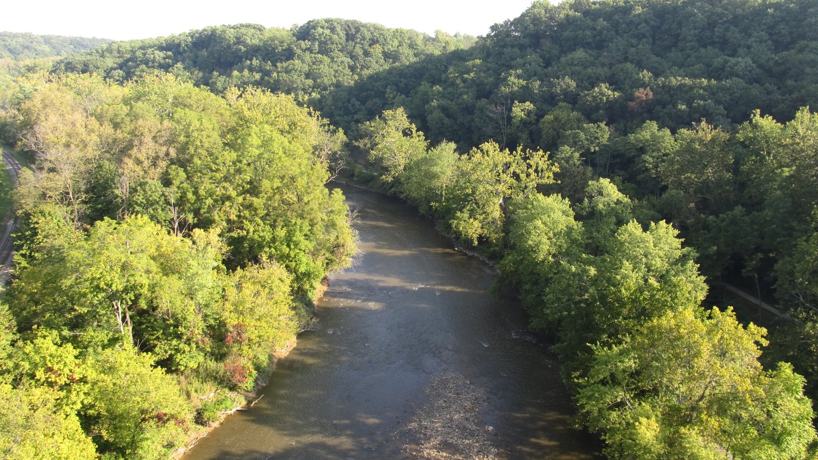
- Inline image: Public trout access in this region is a layered system of federal, state, and local land managers. Photo: Ken Lund / Wikimedia Commons, CC BY-SA 2.0.
- Hero image: Photo: Kathleen Creek / U.S. Forest Service, public domain.
Continue learning
- Inland Trout Near Steelhead Alley -- access map.
- Class A Wild Trout Streams Near the Alley.
- Brook Trout Headwaters Near the Alley.
- Trout Water Classification: OH / PA / NY.
- Trout Stocking Schedules.
- Inland Trout Seasonal Calendar.
- Cuyahoga River Recovery Story -- CVNP context.
- Source Discipline + Tier Hierarchy.